
Community
Ken Barlow has issued a Minnesota’s Weather Authority Alert for possible severe weather later today
By Katherine Langford
Advertisement · Why this ad?
Katherine oversees editorial operations across all six brands. Before joining The Meridan Group, she spent 14 years at the Minneapolis Star Tribune, where she led the metro desk through its digital transformation. She holds a Master's in Journalism from Northwestern's Medill School.
More from Katherine →
As the sun climbs higher in the sky, casting long shadows across our beloved Twin Cities, a palpable sense of anticipation and unease settles over the landscape. With temperatures nearing a muggy 70 degrees and a heavy, humid air pressing down, the atmosphere itself seems charged, reflecting the collective breath held by residents across our communities.
This afternoon, the Twin Cities and surrounding areas are bracing for severe thunderstorms, with a particularly acute risk of tornadoes between 4 p.m. and 6 p.m. This critical two-hour window demands our full attention and preparedness, as meteorologists warn of conditions ripe for significant weather events that could impact every household.
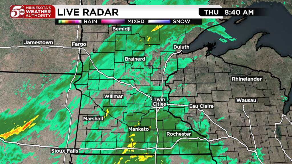
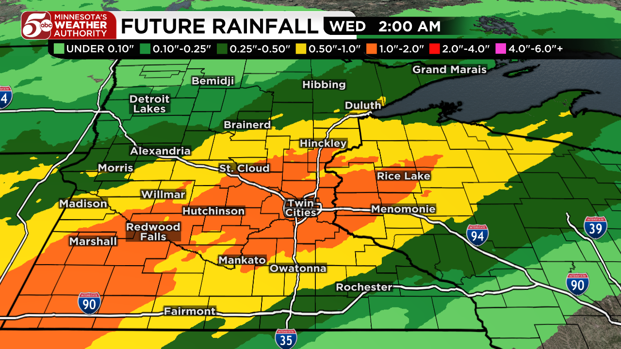
The National Weather Service Twin Cities (NWS MPX) has issued detailed advisories, indicating that these powerful storms will begin developing over southwest Minnesota in the early afternoon. They are projected to approach the western Twin Cities Metro area around 4 p.m., sweep through the core of the Twin Cities by 5 p.m., and then move towards the Minnesota/Wisconsin border in the east Metro by 6 p.m. After this critical period, the immediate threat for severe storms will shift eastward, with no additional T-storms expected overnight.
The primary concern during this 4 p.m. to 6 p.m. timeframe is the potential for tornadoes, driven by an intense wind shear. Surface winds from the southeast, veering sharply to the southwest at 5,000 feet, will create a twisting motion in the atmosphere—a classic precursor to tornadic activity. Beyond the tornado risk, residents should also prepare for heavy rain, large hail, and damaging gusty winds, all of which can cause significant property damage and widespread power outages.
Temperatures ahead of the storms are expected to reach the upper 60s to near 70 degrees, with dew point temperatures approaching 60 degrees, contributing to the muggy conditions that often precede severe weather. These atmospheric ingredients combine to create an environment where rapid storm development and intensification are highly probable, making vigilance paramount for every family and business.
Across Edina and neighboring communities, local families are already preparing for potential disruptions, ensuring their loved ones are safe and secure. This proactive spirit is a hallmark of our community, where the well-being of children and the stability of our homes are cherished above all else. Neighbors are checking in on each other, fostering a vital sense of community amidst the looming storm, demonstrating the strength found in mutual care and support.
The threat of severe thunderstorms impacts not only individual households but the broader community, as local emergency services prepare to respond with unwavering dedication. This situation underscores the importance of community readiness and resilience in the face of nature's unpredictability, reminding us that we are stronger together. As a spokesperson for the Hennepin County Sheriff's Office emphasized, "The safety of our residents is our utmost priority. We urge everyone to take these warnings seriously and prepare accordingly."
For every family, having a clear emergency plan is essential. This includes identifying safe spaces within your home, such as a basement or an interior room on the lowest floor, away from windows. It is also crucial to have an emergency kit stocked with essentials like water, non-perishable food, flashlights, batteries, and a first-aid kit. Resources like Ready.gov's tornado preparedness guide offer comprehensive advice for securing your household.
Parents are encouraged to discuss these plans with their children, ensuring everyone knows what to do if a warning is issued. This proactive approach not only enhances safety but also instills a sense of calm and control during potentially frightening events. The stability of our households, built on strong communication and preparedness, forms the bedrock of a resilient community.
Our local institutions are also taking significant steps. Edina Public Schools, for instance, will be closely monitoring the situation for any necessary adjustments to after-school activities or dismissal procedures, prioritizing student safety above all else. The City of Edina Official Website and Hennepin County Emergency Preparedness pages are invaluable resources for real-time updates and local guidance.
At a broader level, the Minnesota Department of Public Safety - Homeland Security and Emergency Management (HSEM) coordinates statewide efforts, ensuring that resources are available should they be needed. Organizations like the American Red Cross - Minnesota Region stand ready to provide critical disaster relief services, including shelter and aid, in the aftermath of severe weather, embodying the spirit of compassionate service.
Residents are strongly advised to stay informed by monitoring local news outlets like KSTP 5 Weather Forecast and official weather alerts from the National Weather Service. Having multiple ways to receive warnings, such as weather radio, smartphone alerts, and local television, is crucial, especially during the critical 4 p.m. to 6 p.m. window.
While the immediate focus is on preparedness, our community also looks ahead to the potential aftermath. Property damage, power outages, and travel disruptions are all possible impacts. However, the strength of our community lies not just in how we prepare, but in how we recover. The bonds forged between neighbors, often strengthened by shared faith and a commitment to civic duty, will be vital in supporting those who may be affected.
The American dream, at its heart, is about building stable, loving households and communities that endure. When challenges arise, whether from economic hardship or natural disaster, it is the collective spirit of mutual aid and unwavering support that sees us through. This commitment to one another is a testament to the enduring values that define our region.
As the clock ticks towards the critical afternoon hours, the Twin Cities stand united. The threat of severe weather, while serious, serves as a powerful reminder of our shared humanity and the importance of community. After 6 p.m., as the storm threat moves eastward, we anticipate a return to calmer conditions overnight, allowing our communities to assess and recover.
Amidst the anxiety of impending storms, there is a collective resolve to protect one another and weather the challenges together. As the clouds gather and the winds begin to swirl, the Twin Cities stand united, a testament to the strength of community in the face of adversity. By staying informed, preparing diligently, and supporting our neighbors, we will navigate this challenge with grace and resilience, emerging stronger on the other side.
By Katherine Langford
By Marcus Chen
By Katherine Langford
By Katherine Langford